![An Australian Government Initiative [logo]](/images/austgovt_brown_90px.gif)

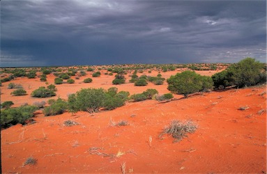 Acacia shrubland dominated by Acacia ligulata on red sand, near Inamincka, SA |
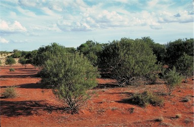 Acacia shrubland dominated by Acacia carnei, red sandy soil, near Tibooburra, NSW |
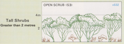
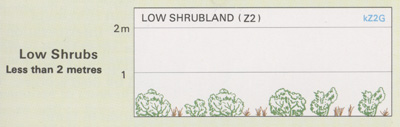
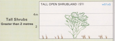
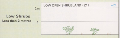
Foliage cover of tallest stratum 30 - 70% |
Acacia Shrublands
- Typified by an overstorey dominated by multi- stemmed acacia shrubs
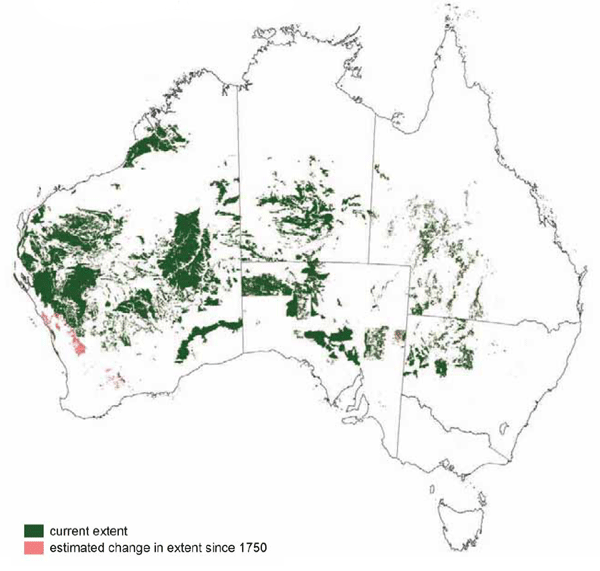
- Occur mainly in temperate semi-arid and arid regions of Australia, although they also extend into the tropical arid regions of north-west Queensland and eastern Northern Territory
- Occur mainly on extensive undulating plains and downs, low hills and valleys of range country
- Climatic conditions are generally dry, hot summers, with cool to warm winters
- Dominated by Acacia aneura (mulga),
A. cambadgei (gidgee) and mixed species
communities of the central Australian deserts, but it also includes a series of other desert acacia communities
- Associated species include Grevillea spp., Eremophila spp. (emu bushes) and a wide range of chenopod/saltbush species including Atriplex, Maireana, Sclerolaena and Senna spp.
Little of this group has been cleared outside the major agricultural zones. Significant areas of the Acacia Shrublands have been modified by grazing from domestic stock and ferals, introduction of exotic weeds (e.g. buffel grass) and from altered fire regimes.
![]() Photos from the Australian Plant Image Index
Photos from the Australian Plant Image Index
Sources: Australia's Native Vegetation - from rainforest to spinifex, map and information poster produced by the National Land & Water Audit, Natural Heritage Trust, Australian Government, 2001
Map: Australia's Native Vegetation - A summary of Australia's Major Vegetation Groups, 2007, Australian Government website
https://www.environment.gov.au/system/files/resources/a9897cf2-9d38-4201-bea2-13dadf3af9a8/files/major-veg-summary.pdf
Structure diagram: Atlas of Australian Resources - Vol. 6, Vegetation,
AUSLIG, Canberra, 1990